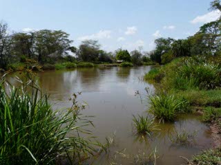
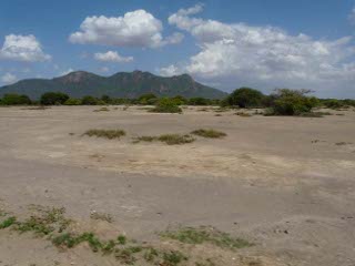
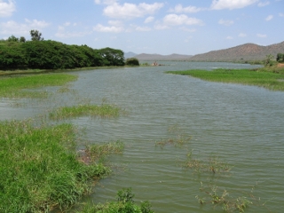
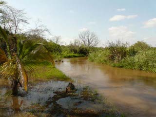
 The Pangani River Basin in Tanzania offers an excellent study site. The Pangani Basin has an estimated population of 3.7 million people, 80% of whom rely, either directly or indirectly, on agriculture for their livelihoods (IUCN 2003). The main river drains the southern side of Mt Kilimanjaro as well as Mt Meru and other parts of the Eastern Arc mountains. It passes the dry Maasai Steppe of northern Tanzania and reaches the Indian Ocean at the town of Pangani. The river has major hydropower, irrigation, urban and rural water supply functions which support almost 3 million livelihoods. Surface runoff has decreased in recent years putting the whole land use system under pressure. Productivity in Pangani Basin - including agriculture, hydropower generation and other ecosystem services - depends on an adequate supply of water. Almost 90% of the surface flow in the Pangani Basin is used for irrigation and hydropower generation. However, many irrigation schemes are not water-efficient and may prompt salinity. Additionally, increasing demands for land resulted in deforestation which reduced water retention and increased erosion and flooding events. However, the biodiversity of the region, considered one of the biodiversity hotspots of the world, resulted from the variety and spatial extension of forests (IUCN 2003). This conflict between demand for agricultural land and preservation of natural forests on the one hand and responses of forests and land uses to increasing aridity on the other hand needs to be modelled in a spatially explicit way in order to devise appropriate adaptation and mitigation strategies.
 We will use an integrated landscape model that is parameterised with field data to address this modelling task. There are several examples of successful applications of comparable landscape models for equivalent tasks, especially in forest ecology and management (Kurz et al., 2000; Liu & Ashton, 1998). Some landscape models explicitly evaluate the effect of management scenarios on habitat quality (Gaff et al., 2000; Li et al., 2000) of species. Other landscape models deal with broad scale landscape management (Childress et al., 2002; Mouillot et al., 2001; Rushton et al., 1995) or with the quantification of landscape scale carbon budgets and fluxes for different management scenarios (Euskirchen et al., 2002; Hill et al., 2003). However, none of these approaches is generic so that it is easily adoptable in the Pangani catchment. Schröder et al. (2008) developed a landscape model to investigate the ecological consequences and costs of different management regimes in semi-natural grasslands. The model integrates dynamic abiotic conditions, management (i.e. disturbance) regime and response of more than 50 characteristic plant and insect species by modelling the dynamics of relevant niche parameters as predictors for species distribution models. This modelling shell was extended by Kattwinkel et al. (2009). Peppler-Lisbach (2003) has shown that the same statistical procedures used for the prediction of species can be applied also to vegetation and land cover types. We propose to further extend the model developed by Schröder et al. (2008) and Kattwinkel et al. (2009) to a landscape prediction and planning tool that can be applied to the research questions in the Pangani catchment.
 Under the socio-economic perspective, the region is characterised by strong populations growth, urbanisation trends, high unemployment in the formalised sector as well as significant poverty rates. The expected changes in water availability will most likely lead to intensified conflicts over water in the entire basin (see e.g. Brockington 2004). The ongoing Pangani River Management Project initiated by IUCN and the Tanzanian Government has developed first general response strategies that need to be complemented by local studies as planned in Clim-A-Net. The study team will select one or two subregions and communities in the basin with which participatory processes will be conducted to devise adaptation options and strategies for the particular communities.
References
- Brockington, D. (2004) Community Conservation, Inequality and Injustice: Myths of Power in Protected Area Management. Conservation & Society, 2 (2), 411-432.
- Childress, W.M., Coldren, C.L., & McLendon, T. (2002) Applying a complex, general ecosystem model (EDYS) in large-scale land management. Ecological Modelling, 153, 97-108.
- Euskirchen, E.S., Chen, J., Li, H., Gustafson, E.J., & Crow, T.R. (2002) Modeling landscape net ecosystem productivity (LandNEP) under alternative management regimes. Ecological Modelling, 154, 75-91.
- Gaff, H., DeAngelis, D.L., Gross, L.J., Salinas, R., & Shorrosh, M. (2000) A dynamic landscape model for fish in the Everglades and its application to restoration. Ecological Modelling, 127, 33-52.
- Hill, M.J., Braaten, R., & McKeon, G.M. (2003) A scenario calculator for effects of grazing land management on carbon stocks in Australian rangelands. Environmental Modelling and Software, 18, 627-644.
- IUCN Eastern Africa Programme (2003) The Pangani River Basin: A Situation Analysis, Gland: IUCN.
- Kattwinkel, M., Strauss, B., Biedermann, R. & Kleyer, M. (2009) Modelling multi-species response to landscape dynamics: Mosaic cycles support urban biodiversity. Landscape Ecology 24: 929-941.
- Kurz, W.A., Beukema, S.J., Klenner, W., Greenough, J.A., Robinson, D.C.E., Sharpe, A.D., & Webb, T.M. (2000) TELSA: the tool for exploratory landscape scenario analyses I. Computers and electronics in agriculture, 27, 227-242.
- Li, H., Gartner, D.I., Mou, P., & Trettin, C.C. (2000) A landscape model (LEEMATH) to evaluate effects of management impacts on timber and wildlife habitat. Computers and electronics in agriculture, 27,263-292.
- Liu, J. & Ashton, P.S. (1998) Formosaic : An individual-based spatially explicit model for simulating forest dynamics in landscape mosaics. Ecological Modelling, 106, 177-200.
- Mouillot, F., Rambal, S., & Lavorel, S. (2001) A generic process-based SImulator for meditERRanean landscApes (SIERRA): design and validation exercises. Forest ecology and management, 147, 75-97.
- Peppler-Lisbach, C. (2003): Predictive modelling of recent and historical land-use patterns. Phytocoenologia 33(4): 565-590.
- Rushton, S.P., Cherrill, A.J., Tucker, K., & O'Callaghan, J.R. (1995) The ecological modelling system of NELUP. Journal of environmental planning and management, 38, 35-52.
- Schroder B., Rudner M., Biedermann R., Kogl H. & Kleyer M. (2008) A landscape model for quantifying the trade-off between conservation needs and economic constraints in the management of a seminatural grassland community. Biological Conservation, 141, 719-732.


